
Israeli Communities in Judea and
Cite this page
Israel NOWlej (2027), MAP-026, pp. 54 to 55, israelnowlej.com/map-026
Short address: israelnowlej.com/map-026
Text of this page
MAP 26
J O R D A N
I S R A E L
Dead Sea
SHOMRON
31 communities
JORDAN VALLEY
21 communities
BINYAMIN
55 communities
GUSH ETZION
14 communities MEGILOT
6 communities
HAR HEVRON
16 communities
Jerusalem Jerusalem
Alfei Menashe Alfei Menashe
Karnei Shomron Karnei Shomron
Kedumim Kedumim Oranit Oranit
Elkana Elkana Immanuel Immanuel
Shaar Shomron Shaar Shomron
Maale Efraim Maale Efraim
Beit Aryeh Beit Aryeh
Beit El Beit El
Givat Zeev Givat Zeev
Har Adar Har Adar
Efrat Efrat
Hebron Hebron
Kiryat Arba Kiryat Arba
Ariel Ariel
Modiin Illit Modiin Illit
Maale Adumim Maale Adumim
Beitar Illit Beitar Illit
Hadera Hadera
Netanya Netanya
Kfar Saba Kfar Saba
Tel Aviv-Yafo Tel Aviv-Yafo
Beit Shemesh Beit Shemesh
L E G E N D
City
Smaller municipality or community
1949 armistice line International border today
N
20 km
12 mi
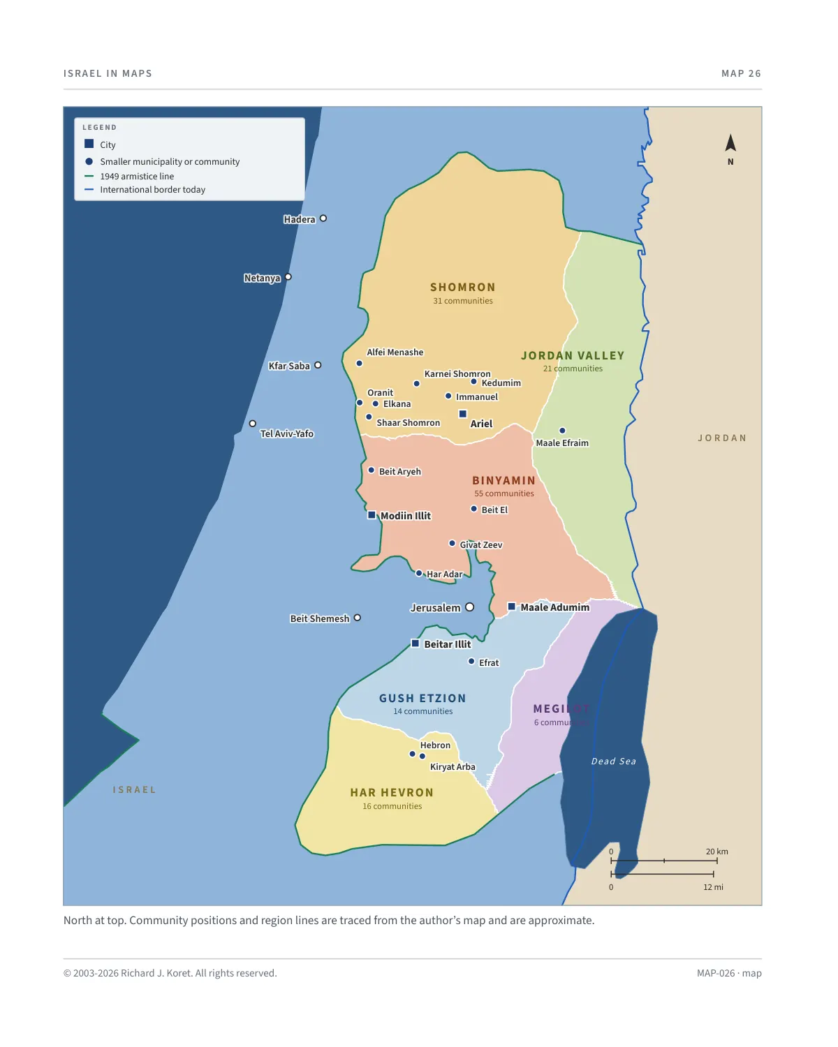
North at top. Community positions and region lines are traced from the author’s map and are approximate.
MAP-026 · map
HISTORICAL MAPS
MAP 26 Israeli Communities in Judea and Samaria
Regions, cities and principal communities
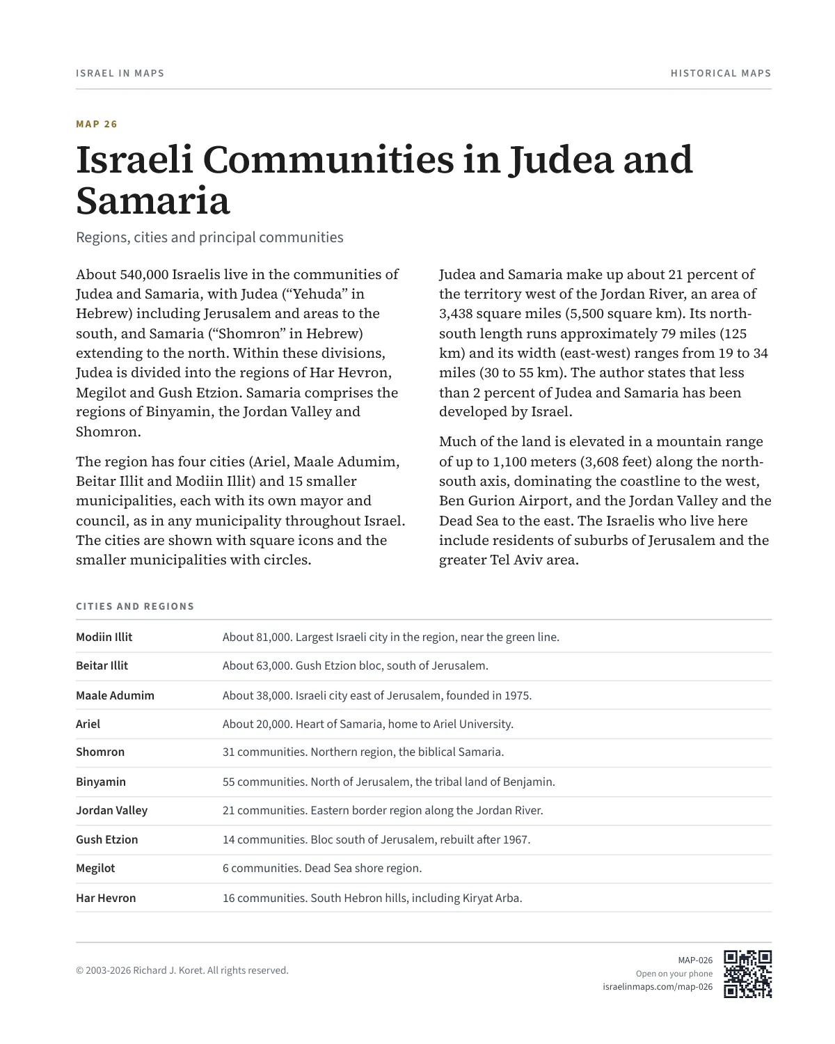
About 540,000 Israelis live in the communities of Judea and Samaria, with Judea (“Yehuda” in Hebrew) including Jerusalem and areas to the south, and Samaria (“Shomron” in Hebrew) extending to the north. Within these divisions, Judea is divided into the regions of Har Hevron, Megilot and Gush Etzion. Samaria comprises the regions of Binyamin, the Jordan Valley and Shomron.
The region has four cities (Ariel, Maale Adumim, Beitar Illit and Modiin Illit) and 15 smaller municipalities, each with its own mayor and council, as in any municipality throughout Israel. The cities are shown with square icons and the smaller municipalities with circles.
Judea and Samaria make up about 21 percent of the territory west of the Jordan River, an area of 3,438 square miles (5,500 square km). Its north- south length runs approximately 79 miles (125 km) and its width (east-west) ranges from 19 to 34 miles (30 to 55 km). The author states that less than 2 percent of Judea and Samaria has been developed by Israel.
Much of the land is elevated in a mountain range of up to 1,100 meters (3,608 feet) along the north- south axis, dominating the coastline to the west, Ben Gurion Airport, and the Jordan Valley and the Dead Sea to the east. The Israelis who live here include residents of suburbs of Jerusalem and the greater Tel Aviv area.
CITIES AND REGIONS
Modiin Illit About 81,000. Largest Israeli city in the region, near the green line.
Beitar Illit About 63,000. Gush Etzion bloc, south of Jerusalem.
Maale Adumim About 38,000. Israeli city east of Jerusalem, founded in 1975.
Ariel About 20,000. Heart of Samaria, home to Ariel University.
Shomron 31 communities. Northern region, the biblical Samaria.
Binyamin 55 communities. North of Jerusalem, the tribal land of Benjamin.
Jordan Valley 21 communities. Eastern border region along the Jordan River.
Gush Etzion 14 communities. Bloc south of Jerusalem, rebuilt after 1967.
Megilot 6 communities. Dead Sea shore region.
Har Hevron 16 communities. South Hebron hills, including Kiryat Arba.
MAP026 Open on your phone $.- ’)*2’ % *(„( +›
Corrections: none recorded. This is the current version. The 2027 print edition copy is at israelnowlej.com/2027/map-026.