
Gaza Peace Plan and Control
Cite this page
Israel NOWlej (2027), MAP-025, pp. 52 to 53, israelnowlej.com/map-025
Short address: israelnowlej.com/map-025
Text of this page
MAP 25
M E D I T E R R A N E A N
S E A
E G Y P T
Beit Lahia Beit Lahia
Beit Hanun Beit Hanun
Gaza City Gaza City
Bureij Bureij
Deir el Balah Deir el Balah
Khan Yunis Khan Yunis
Khuzaah Khuzaah
Rafah Rafah
L E G E N D
Palestinian-held area
Held by Israel, east of the Yellow Line
Yellow Line, from October 2025
Israeli line before the ceasefire
Second withdrawal (planned)
Third withdrawal: border buffer (planned)
Gaza border
Egypt border
N
10 km
6 mi
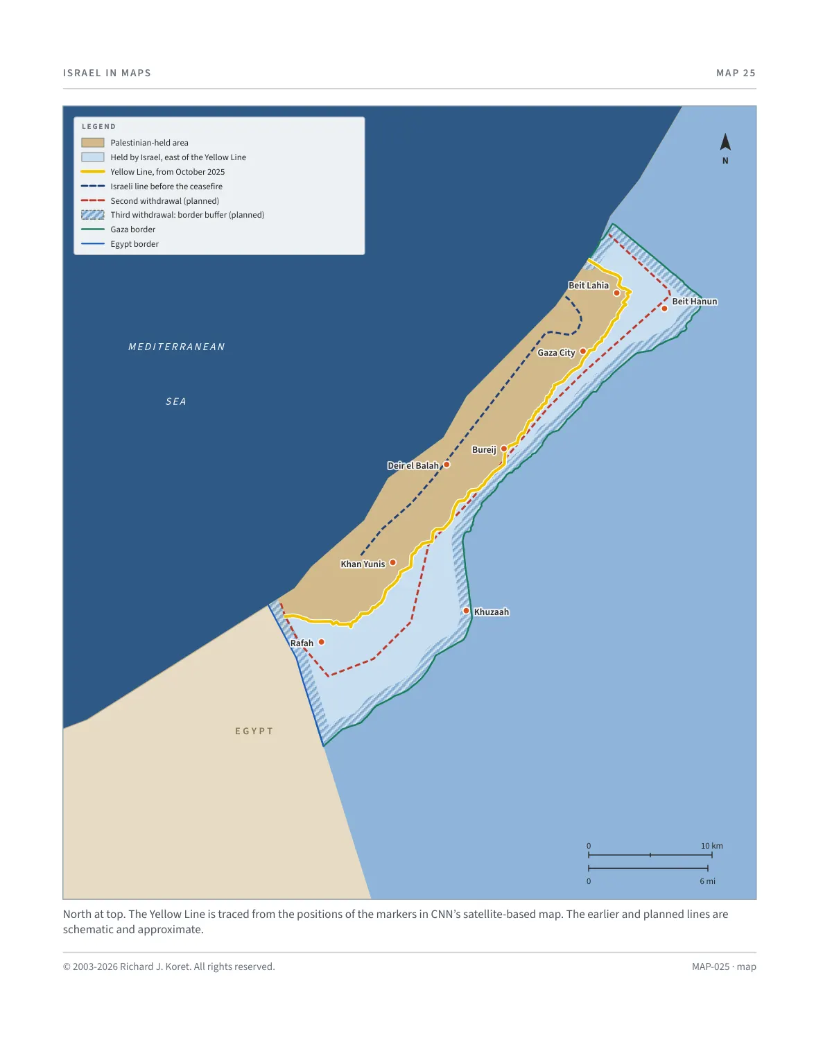
North at top. The Yellow Line is traced from the positions of the markers in CNN’s satellite-based map. The earlier and planned lines are schematic and approximate.
MAP-025 · map
HISTORICAL MAPS
MAP 25 Gaza Peace Plan and Control
Sources: CNN (satellite imagery of Israeli Yellow Line markers), CBS News, Wikipedia, and a
MAP025 Open on your phone
The Yellow Line and the planned withdrawals
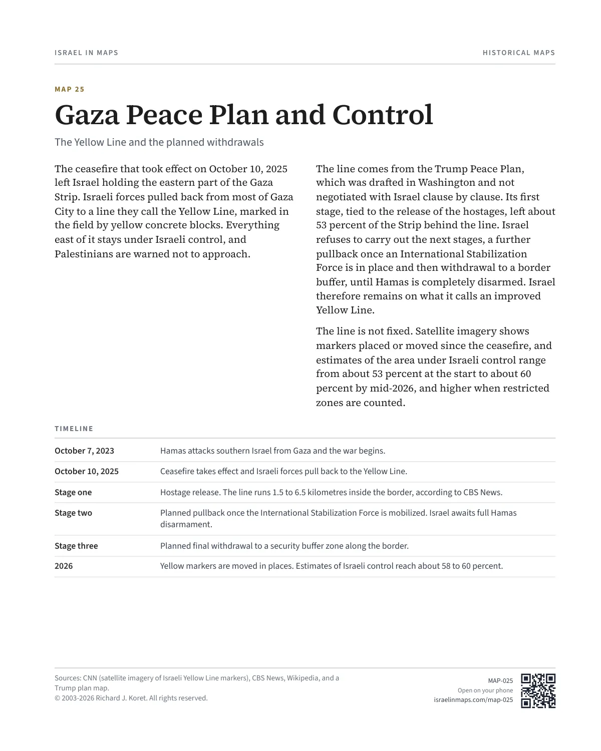
The ceasefire that took effect on October 10, 2025 left Israel holding the eastern part of the Gaza Strip. Israeli forces pulled back from most of Gaza City to a line they call the Yellow Line, marked in the field by yellow concrete blocks. Everything east of it stays under Israeli control, and Palestinians are warned not to approach.
The line comes from the Trump Peace Plan, which was drafted in Washington and not negotiated with Israel clause by clause. Its first stage, tied to the release of the hostages, left about 53 percent of the Strip behind the line. Israel refuses to carry out the next stages, a further pullback once an International Stabilization Force is in place and then withdrawal to a border buffer, until Hamas is completely disarmed. Israel therefore remains on what it calls an improved Yellow Line.
The line is not fixed. Satellite imagery shows markers placed or moved since the ceasefire, and estimates of the area under Israeli control range from about 53 percent at the start to about 60 percent by mid-2026, and higher when restricted zones are counted.
TIMELINE
October 7, 2023 Hamas attacks southern Israel from Gaza and the war begins.
October 10, 2025 Ceasefire takes effect and Israeli forces pull back to the Yellow Line.
Stage one Hostage release. The line runs 1.5 to 6.5 kilometres inside the border, according to CBS News.
Stage two Planned pullback once the International Stabilization Force is mobilized. Israel awaits full Hamas disarmament.
Stage three Planned final withdrawal to a security buffer zone along the border.
Yellow markers are moved in places. Estimates of Israeli control reach about 58 to 60 percent.
Trump plan map.
$.- ’)*2’ % *(„( +›
Corrections: none recorded. This is the current version. The 2027 print edition copy is at israelnowlej.com/2027/map-025.