
Judea and Samaria
Cite this page
Israel NOWlej (2027), MAP-022, pp. 46 to 47, israelnowlej.com/map-022
Short address: israelnowlej.com/map-022
Text of this page
MAP 22
J O R D A N
I S R A E L
Dead Sea
Jenin Jenin
Nablus Nablus
Ramallah Ramallah
Jericho Jericho
Bethlehem Bethlehem
Hebron Hebron
Tulkarm Tulkarm
Kalkilya Kalkilya
Elon Moreh Elon Moreh
Shilo Shilo
Ariel Ariel
Ofra Ofra Beit El Beit El
Maale Adumim Maale Adumim
Kfar Etzion Kfar Etzion Efrat Efrat
Kiryat Arba Kiryat Arba
Kfar Saba Kfar Saba
Netanya Netanya
Hadera Hadera
Tel Aviv-Jaffa Tel Aviv-Jaffa
Beit Shemesh Beit Shemesh
Jerusalem Jerusalem
L E G E N D
Area A: Palestinian civil and security control
Area B: Palestinian civil, Israeli security control
Area C: full Israeli control
1949 armistice line
International border today
Israeli community Palestinian community
N
20 km
12 mi
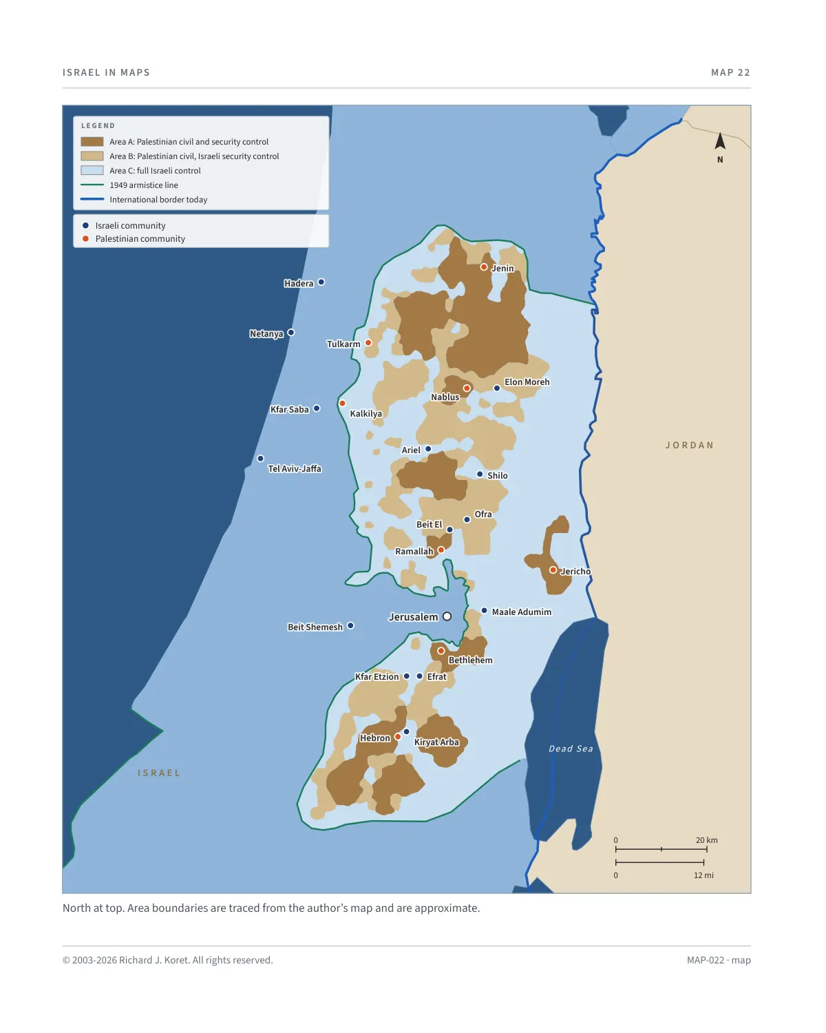
North at top. Area boundaries are traced from the author’s map and are approximate.
MAP-022 · map
HISTORICAL MAPS
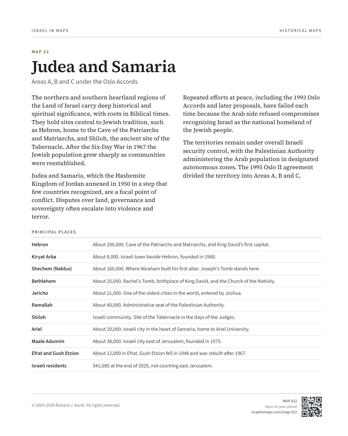
MAP 22 Judea and Samaria
Areas A, B and C under the Oslo Accords
The northern and southern heartland regions of the Land of Israel carry deep historical and spiritual significance, with roots in Biblical times. They hold sites central to Jewish tradition, such as Hebron, home to the Cave of the Patriarchs and Matriarchs, and Shiloh, the ancient site of the Tabernacle. After the Six-Day War in 1967 the Jewish population grew sharply as communities were reestablished.
Judea and Samaria, which the Hashemite Kingdom of Jordan annexed in 1950 in a step that few countries recognized, are a focal point of conflict. Disputes over land, governance and sovereignty often escalate into violence and terror.
Repeated efforts at peace, including the 1993 Oslo Accords and later proposals, have failed each time because the Arab side refused compromises recognizing Israel as the national homeland of the Jewish people.
The territories remain under overall Israeli security control, with the Palestinian Authority administering the Arab population in designated autonomous zones. The 1995 Oslo II agreement divided the territory into Areas A, B and C.
PRINCIPAL PLACES
Hebron About 200,000. Cave of the Patriarchs and Matriarchs, and King David’s first capital.
Kiryat Arba About 8,000. Israeli town beside Hebron, founded in 1968.
Shechem (Nablus) About 160,000. Where Abraham built his first altar. Joseph’s Tomb stands here.
Bethlehem About 25,000. Rachel’s Tomb, birthplace of King David, and the Church of the Nativity.
Jericho About 21,000. One of the oldest cities in the world, entered by Joshua.
Ramallah About 40,000. Administrative seat of the Palestinian Authority.
Shiloh Israeli community. Site of the Tabernacle in the days of the Judges.
Ariel About 20,000. Israeli city in the heart of Samaria, home to Ariel University.
Maale Adumim About 38,000. Israeli city east of Jerusalem, founded in 1975.
Efrat and Gush Etzion About 12,000 in Efrat. Gush Etzion fell in 1948 and was rebuilt after 1967.
Israeli residents 541,085 at the end of 2025, not counting east Jerusalem.
MAP022 Open on your phone $.- ’)*2’ % *(„( +›
Corrections: none recorded. This is the current version. The 2027 print edition copy is at israelnowlej.com/2027/map-022.